Introduction of Transit Oriented Development in metro cities: A case study of Kochi

Introduction
The urban population in the world has grown significantly from 751
million in 1950 to 4.2 billion in 2018. The world’s urban population now
exceeds the rural population. The most urbanized regions are North America
(82%), Latin America and the Caribbean (81%), Europe (74%) and Oceania (68%)
The McKinsey Global Institute (2013) estimates that the global
infrastructure cost between 2013 and 2030 would be $57 trillion - $3.2 trillion
a year to keep up with the projected global GDP growth and 40 percent of these
infrastructure needs consists of transportation infrastructure. Jacobs (1969)
has referred to cities as the place where growth occurs and as engines of
growth. However, if cities are not planned well, they could impact the economic
output by reducing agglomeration of economic activities, access to jobs, social
inclusion, inequalities in housing, thereby raising infrastructure costs.
Transit Oriented Development (TOD), is a planning strategy that integrates urban places to bring people, activities, buildings and public spaces together around public transport system and provides an excellent transit service to the remaining city. According to the National Transit Oriented Development Policy, TOD focuses on creating high density mixed land use development within walking distances of transit stations and it advocates pedestrian trips in order to access facilities like shopping, entertainment and work. TOD aims to improve the accessibility of transit stations by creating pedestrian and Non-Motorized Transport (NMT) friendly infrastructure that benefit a large number of people, increasing the ridership of the transit facility and in turn improving the economic and financial viability of the system.
An influence zone is the area in the immediate vicinity of the transit location. It can be a delineated zone, within 10-12 minutes of walking around the transit station. These influence areas should be provided with higher Floor Area Ratio (FAR) / Floor Space Index (FSI), Higher population and job density as compared to the area beyond the influence zone. This zone would thus act as a magnet and bring together people, increasing the ridership, enhancing fare revenues simultaneously bringing down pollution and congestion rates. High density compact development, mixed use development, mandatory and inclusive housing and sustainable mobility characteristics such as multi-modal integration, inclusion of pedestrian and NMT infrastructure, designed public spaces and managed parking are the different approaches considered in designing a successful TOD in the influence area.
World Business Council for Sustainable Development (WBCSD) defines sustainable mobility as ‘the ability to meet the societal needs to gain access, trade, communicate, move freely and establish links that do not compromise on the future human or ecological needs’. Sustainable urban mobility offers city dwellers, cost effective and efficient transport options giving access to key destinations and services with reduced levels of pollution, green-house gas emissions, energy consumption and improved safety. Sustainable approaches are expected are to enhance the economy, urban design and society holistically.
Consistent policy frameworks and contributions from multiple
stakeholders are needed to achieve longer positive impact on the urban form and maximize resource efficiency. Some successful TOD planning examples are
enhancing social inclusiveness for urban poor in New York, promoting green
growth in Copenhagen, bringing down costs of housing and transportation around
transit stations in Portland, concentrating office spaces in about 1 percent of
the land area in Manhattan, agglomeration economies in London and its quality
of public transit stations and inducing economic growth through rail based high
density development in Hong Kong Special Administrative Region.
Introduction of TOD is also in cognizance with the
Nationally Determined Contribution (NDC) for the period 2021 to 2030. The
assessment report on NDC
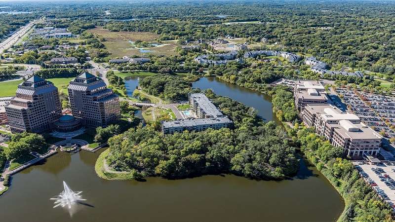
Kochi, one of the largest cities in Kerala has witnessed
construction of skyscrapers albeit the demographic intensity has been low and traffic
in Kochi is known to be chaotic with noise, high accident rates, congestion
problems and delayed travel movement. It is the economic capital of Kerala, the
most urbanized district, one percent of the corporation area designated as
green space and a quarter of the city is covered with water bodies. Since the
early nineties, Kochi has been rapidly urbanizing due to influx of people from
different regions for job opportunities. Along with the population increase,
however, the city has not been able to grow due to space constraints. Along
with rapid urbanization, the city also witnessed rapid motorization. Kochi
developed a comprehensive mobility plan to bring back the trend of using public
transport and non-motorized transportation

Figure 1:
Kochi city map (Source: ENVIS Centre on Human Settlement)
Analysis
The Kochi Metro Rail Limited (KMRL) envisioned to introduce a mass public
transportation system in line with the Ministry of Urban Development directives
and with the aid of International and government funding. The rail-based system
was conceptualized to cater to the accentuating demand for an efficient public
transport system. Phase I implementation that runs a length of 25.6 km from
Aluva in the North to Petta in the south. The rail system with 22 stations is
planned along the corridor. Merging the proposed surf ace elevated transit
mode, Metro, to the existing city structure will help create a polarized growth
in the city. Good accessibility, pedestrian pathways, pedestrian friendly
areas, open spaces along transit corridors and organizing mixed development
would assist TOD around the station area.

Figure 2: Route map of Kochi Metro - Phase I
The characteristics of the area that need to be analysed to
study the area are land use, parcel utilization, block size and population
density and the main parameters are transit network, land use, urban structure
and public space. Existing land use of Kochi corporation indicates that
majority of the land cover except for water bodies and agricultural patches are
already developed with the major land use being residential. The city expanded
towards the east from the islands of Fort Cochin and Mattanchery with
commercial activity seen concentrated in the core and industrial activities in
the North-west. Other trends are conversion of land use from residential to
commercial or mixed use, ribbon development of commercial activities along the
highways and the stretch of highway developing into a shopping hub. With the
arrival of the metro, the road traffic can be reduced substantially and carry
higher capacity of people.
Analyzing the metro station area in Edapally, the most
developed areas of Kochi would help give a fair idea of status of
transit-oriented development in the city. It connects Kalamassery in the north
and Kaloor in the south. It has two modes of transport; the road, metro and
newly proposed inland waterway. High density on the road owing to the NH Bypass
and Lulu Mall, the largest in India. The major built use is residential and
commercial along the roads. Characterised by Edapally Canal, that has a
potential of being developed as an inland waterway, the area also compromises
of the pilgrimage centre of St. George church, two mosques and various temples.
Building heights vary from single storey to four storeys with majority along
the metro corridor being double storey buildings. The urban fabric is uneven and
fine grain with a coarse grain texture along the major roads. The site lacks
recreational, open spaces and lack of parking areas around important landmarks.
Public transportation system includes buses, rickshaws, the metro and inland
waterway. Smaller plots with higher built intensity and amalgamated plots for
commercial use are observed around the metro station area. This pattern could
continue to pick up as the metro starts functioning to accommodate real estate
uses.
Edapally metro station is observed to lack safe and easy
accessibility and requisite entry points. The influence area would ideally
require more open spaces and attract public by creating more opportunities.
Safer designs of existing roads, attention to conflict areas, integration of
buses with metro frequency and pedestrian-oriented designs are crucial to
channelise development in the area.
Volume II of the Development Plan for Kochi City Region
2031, proposes new transit-oriented development corridors to stimulate growth
of other growth centres, to attract public and to reduce dependency to the main
city. The two corridors that are identified for development are the Angamaly –
Perumbavur- Kolenchery - Piravom corridor as first phase followed by the
Cherthala - Thalayolaparambu and Thalayolaparambu – Piravom corridor. The stretch linking Angamaly – Nedumbassery –
Aluva – Kalamassery - Kochi - Tripunithura – Mulamthuruthy- Piravom is also to
be promoted to compliment the KodungalurAngamaly- Cherthala corridor. The Kochi
Water Metro Project also works in integration with existing and proposed
transportation systems to develop an effective sustainable water transport
system.
Proposal
The public realm and streetscape within the TOD influence area could
be designed and improvised with landmark structures and defined entry points to
welcome public and make the TOD area more safe, secure and comfortable. The
design should encourage pedestrian and non-motorized activities. Development
should be organized in and around the metro station area, restricting the use
of private vehicles.
Conclusion
The principle of TOD advocates a compact, mixed use, dense
development around a mass transit location in which use of non-motorized transport and walking is encouraged. By clustering jobs, services, amenities
and housing, TOD would bring about healthier lifestyles, reduce pollution, increase
foot-traffic for commercial businesses, decrease sub-urban sprawl and integrate
different modes of transportation and land use. TOD also assists in bringing
about sustainable mobility and way of living. In Kochi, the metro system should
ideally be integrated with the existing city structure using TOD concepts. The
waterways could also be rejuvenated and developed to create active public spaces.
References
(n.d.). City
Mobility Plan - Kochi.
Dhindaw, J., Pai,
M., & Kodukula, S. (2017). New Urban Pathways to Better Air Quality and
Climate Action: Case Study on India.
Ebin, A. D.
(2018). An Integrated Approach to Restructure the Existing City with New
Transport System Using TOD Principles. A case of Kochi. 6th Annual
International Conference on Architecture and Civil Engineering, 191-197.
ERIA Research
Project Report 2012-29. (2013). Study on energy efficiency improvement in
the transport sector through transport improvement and smart community
development in the urban area Working Group - ‘An Overview of Urban Transport
Situation in Asia’. ERIA Research. Retrieved from https://www.eria.org/RPR_FY2012_No.29_Chapter_2.pdf
European
Conference of Ministers of Transport . (2004). ECMT Annual Report.
European Conference of Ministers of Transport.
IBRD-IDA. (2015). The
World Bank Annual Report. The World Bank.
TERI. (2014). Policies
for Sustainable Mobility. New Delhi: The Energy and Resources Institute.
UN DESA. (2018). 2018
Revision of the World Urbanization Prospects. Population Division of the
United Nations Department of Economic and Social Affairs (UN DESA).
UN HABITAT. (2010).
The State of Asian Cities 2010/11. Fukuoka: United Nations Human
Settlements Programme (UN-HABITAT).
(2011). World
automobile statistics. Tokyo: Japan Automobile Manufacture’s Association.